Sanur Tidal Flood Mapping Foundation Elevation Insurance Bali
Sanur Tidal Flood Mapping: Foundation Elevation Insurance Requirements Bali
Sanur’s coastal geography presents a unique construction challenge that many foreign buyers discover only after purchasing land: the intersection of tidal flood risk, foundation engineering requirements, and insurance underwriting standards. Unlike the elevated terrain of Ubud or the cliff formations of Uluwatu, Sanur’s low-lying coastal plain sits barely 1-3 meters above mean sea level in many residential zones. This creates a critical engineering question that affects both construction feasibility and long-term asset protection: what foundation elevation standards must be met to secure property insurance, and how do tidal flood maps influence structural design requirements?
The Technical Reality of Sanur’s Coastal Flood Exposure
Sanur’s vulnerability to tidal flooding stems from its geographic position on Bali’s southeastern coast, where the convergence of astronomical tides, seasonal monsoon patterns, and localized subsidence creates periodic inundation events. The technical challenge for Bali villa construction in this zone extends beyond simple elevation—it requires understanding the interaction between groundwater tables, soil bearing capacity, and structural load distribution in saturated conditions.
Current Flood Mapping Framework in Sanur
Indonesia’s national disaster management agency (BNPB) maintains regional flood hazard maps, but granular, parcel-specific tidal flood mapping for Sanur remains limited in public accessibility. The Denpasar municipal government references coastal flood zones in spatial planning documents (RTRW), yet these designations often lack the engineering precision required for foundation design. International insurance underwriters operating in Bali typically reference their own proprietary flood models, which may classify Sanur properties differently than local planning documents.
The practical implication: two adjacent parcels in Sanur may receive different insurance classifications based on micro-topography, drainage infrastructure proximity, and historical flood event data. This variability makes pre-construction flood risk assessment essential, not optional. Properties within 200 meters of the coastline face heightened scrutiny from insurers, particularly those below the 2-meter elevation threshold relative to mean high water spring tide (MHWS).
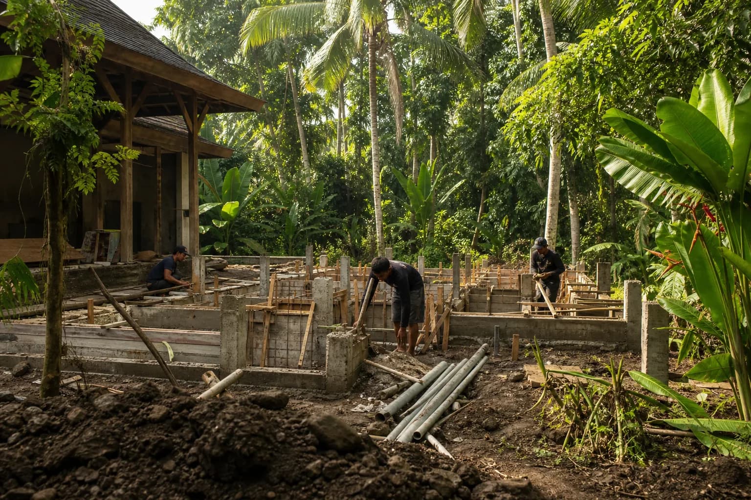
Foundation Elevation Engineering Standards
Indonesian building code (SNI 03-1724-1989 and subsequent revisions) does not mandate specific foundation elevations for coastal residential construction, leaving this determination to engineering judgment and local building permit authorities. However, international insurance underwriters—particularly those providing coverage for foreign-owned properties—increasingly require minimum finished floor elevations (FFE) above established flood reference points.
The engineering approach for flood-resistant foundations in Sanur typically involves one of three strategies:
- Elevated slab-on-grade systems: Importing engineered fill to raise the building pad 0.5-1.5 meters above natural grade, with proper compaction and perimeter drainage
- Raised floor platforms: Constructing habitable space on elevated structural slabs supported by reinforced concrete columns, leaving ground level for parking or non-critical functions
- Hybrid foundation systems: Combining deep pile foundations with elevated floor systems to address both flood risk and poor soil bearing capacity simultaneously
Each approach carries distinct cost implications and construction timeline considerations. The elevated slab method requires significant earthwork and soil stabilization, typically adding 15-25% to foundation costs compared to standard construction. Raised floor platforms increase structural complexity and material requirements, particularly for lateral bracing against seismic loads. The hybrid approach offers superior long-term performance but represents the highest initial capital investment.
Insurance Underwriting Requirements
Property insurance for villa construction cost Bali calculations must account for flood coverage limitations in coastal zones. Standard property policies in Indonesia often exclude or severely limit tidal flood damage, requiring separate flood insurance riders. International underwriters serving the expatriate market apply risk-based pricing that directly correlates to foundation elevation and flood exposure.
The underwriting process typically requires:
- Topographic survey showing existing grade elevations relative to established tidal datums
- Finished floor elevation certification from a licensed engineer
- Drainage plan demonstrating surface water management strategy
- Structural drawings showing foundation type and flood-resistant construction details
- Historical flood event documentation for the specific parcel or immediate vicinity
Properties that cannot demonstrate finished floor elevations at least 0.5 meters above the 100-year flood elevation (where such data exists) may face coverage denials or premium surcharges exceeding 200% of standard rates. This creates a direct financial incentive for proper foundation elevation during initial construction—retrofitting after completion proves exponentially more expensive and often structurally impractical.
Hidden Risks Buyers Miss in Sanur Coastal Construction
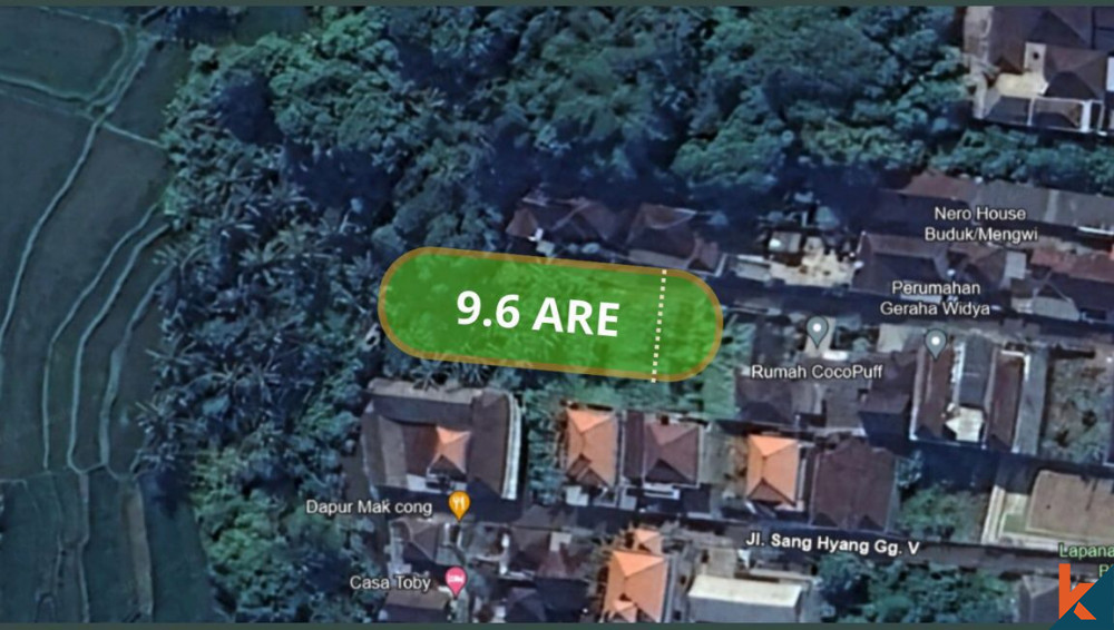
The most critical oversight in Sanur land purchase Bali transactions involves the disconnect between land price, buildable area, and actual construction costs once flood mitigation requirements are factored. A seemingly affordable beachside parcel may require foundation engineering that consumes 30-40% of the total construction budget, fundamentally altering project economics.
The Groundwater Table Complication
Sanur’s high groundwater table—often encountered at 1-2 meters below natural grade—creates a hidden construction challenge that compounds flood risk. Excavation for foundations, utilities, or pools requires continuous dewatering, and permanent below-grade spaces face perpetual hydrostatic pressure. This geological reality makes basement construction essentially unfeasible and complicates even shallow foundation work. The interaction between tidal cycles and groundwater levels means that water table elevations fluctuate seasonally, requiring foundation designs that account for saturated soil conditions even during dry periods.
Drainage Infrastructure Dependencies
Individual property flood protection in Sanur depends heavily on municipal drainage infrastructure that property owners cannot control. Poorly maintained or undersized drainage channels in surrounding areas can render even properly elevated foundations vulnerable to ponding and localized flooding. The legal framework for drainage easements and maintenance responsibilities remains ambiguous in many Sanur neighborhoods, creating long-term risk exposure that insurance policies may not adequately address.
The Insurance Coverage Gap
Many buyers assume that meeting building permits Bali requirements automatically ensures insurability—a dangerous misconception. Local building permits focus primarily on structural safety and zoning compliance, not flood risk mitigation to international insurance standards. This creates scenarios where legally permitted construction remains uninsurable or requires prohibitively expensive coverage. The gap becomes particularly problematic for leasehold Bali properties, where lenders or lease agreements may mandate insurance coverage that the constructed building cannot obtain at reasonable cost.
Step-by-Step Process for Flood-Resilient Foundation Planning
Phase 1: Pre-Purchase Flood Risk Assessment
Before committing to land purchase Bali in Sanur, commission a preliminary flood risk evaluation that includes topographic survey, historical flood event research, and insurance pre-qualification inquiry. This assessment should identify the parcel’s elevation relative to mean sea level, proximity to drainage infrastructure, and any documented flooding history. Contact potential insurance providers with parcel coordinates to obtain preliminary underwriting guidance—this prevents discovering insurability issues after purchase.
Phase 2: Geotechnical Investigation with Flood Focus
Standard soil boring investigations must be supplemented with groundwater monitoring and seasonal water table documentation. The geotechnical report should specifically address foundation design recommendations for flood-prone conditions, including soil bearing capacity in saturated states and recommendations for foundation elevation. This investigation typically requires 2-3 site visits across different tidal and seasonal conditions to capture water table variability.
Phase 3: Foundation Design to Insurance Standards
Engage structural engineers experienced in tropical construction engineering who understand both Indonesian building codes and international insurance requirements. The foundation design must explicitly target finished floor elevations that meet or exceed insurance underwriting thresholds—typically 0.5-1.0 meters above the highest documented flood level or projected 100-year flood elevation. Design documentation should include specific flood-resistant construction details: waterproof membranes, elevated mechanical systems, and drainage provisions.
Phase 4: Permit Application with Flood Mitigation Documentation
Building permit applications for coastal Sanur properties should include supplementary documentation demonstrating flood risk mitigation: drainage plans, finished floor elevation certifications, and structural details showing flood-resistant construction methods. While not always required by local authorities, this documentation streamlines insurance underwriting and demonstrates due diligence. Teville’s construction process integrates these requirements from initial permitting through final certification.
Phase 5: Construction Monitoring and Elevation Verification
During construction, independent surveying should verify that finished floor elevations match design specifications—deviations of even 10-20 centimeters can affect insurance eligibility. Foundation work in high groundwater conditions requires careful scheduling around tidal cycles and may necessitate temporary dewatering systems. Quality control becomes critical, as remediation after concrete placement proves extremely costly. Final as-built surveys and engineer certifications provide the documentation insurers require for policy issuance.
Realistic Cost Implications and Timeline Considerations
Foundation elevation requirements in Sanur directly impact both construction budgets and project schedules. A standard villa foundation on favorable inland terrain might represent 12-15% of total construction costs, while flood-mitigated coastal foundations can consume 20-30% of the budget.
Cost Ranges for Flood-Resistant Foundations
For a typical 200-square-meter villa in coastal Sanur:
- Elevated slab-on-grade (0.8m raise): IDR 180-250 million additional cost beyond standard foundation, including engineered fill, compaction, and perimeter drainage
- Raised floor platform system: IDR 280-400 million for structural column grid and elevated slab, depending on span requirements and finish specifications
- Hybrid pile-and-platform system: IDR 350-500 million for combined deep foundation and elevated floor structure
These figures represent incremental costs above baseline foundation work and vary based on soil conditions, groundwater depth, and specific elevation requirements. Insurance premium differences add ongoing costs: properly elevated properties may secure coverage at IDR 15-25 million annually, while marginally elevated or non-compliant structures face premiums of IDR 40-60 million or coverage denial.
Timeline Extensions
Flood-resistant foundation construction extends project schedules by 3-6 weeks compared to standard inland construction. Groundwater management, additional compaction time for fill materials, and more complex formwork for elevated structures all contribute to timeline impacts. Seasonal considerations become critical—foundation work during peak monsoon periods (December-February) faces significant weather delays and groundwater management challenges.
For detailed cost estimation specific to your Sanur project parameters, Teville’s cost estimation service provides engineering-based budget ranges that account for site-specific flood mitigation requirements.
Frequently Asked Questions: Sanur Flood Risk and Foundation Requirements
Do all Sanur properties require elevated foundations for insurance coverage?
Not uniformly—insurance requirements vary based on specific parcel elevation, distance from coastline, and historical flood documentation. Properties above 3 meters elevation and beyond 300 meters from the coast typically face standard underwriting. However, the majority of desirable beachside parcels fall into elevated-risk categories requiring foundation elevation documentation. The only reliable approach involves pre-purchase insurance consultation with specific parcel coordinates, as generalized assumptions prove unreliable across Sanur’s varied micro-topography.
Can I retrofit foundation elevation after construction if insurance becomes unavailable?
Structural retrofitting to raise finished floor elevations post-construction ranges from extremely expensive to technically impossible, depending on the original foundation system. Raising an existing slab-on-grade structure requires house-lifting techniques costing IDR 400-800 million for a typical villa—often exceeding 40% of original construction costs. Buildings on shallow foundations without adequate structural capacity for lifting may require partial demolition and reconstruction. This reality makes proper elevation during initial construction the only economically rational approach for coastal Sanur properties.
How do leasehold agreements interact with flood insurance requirements?
Many leasehold Bali agreements for coastal properties include clauses requir
 164 m²7 month(s)from 79.000 USD
TALA TWO
 4344 m²16 month(s)from 290.000 USD
Radha
 3180 m²7 month(s)from 142.000 USD
Vasudeva
164 m²7 month(s)from 79.000 USDPrivate: Haridas Villas, Tegallalang
 172 m²8 month(s)from 120.000 USD
Keshava
 3127 m²9 month(s)from 177.000 USD
Mukunda
 2144 m²11 month(s)from 104.000 USD
Narayana
 3124 m²6 month(s)from 123.000 USD
TALA 8
 1from 198.000 USD
Private: Haridas Villas
 3104 m²11 month(s)from 99.000 USD
TALA 100
 3173 m²6 month(s)from 125.000 USD
TALA FOUR

Want to calculate?
Start With Real Numbers, Not Guesses
Before buying land or finalizing a design, check the realistic build cost range for your project in Bali.
Our team reviews your inputs and gives a grounded estimate.
Available lands
 515 m²7 min$ 570813Bali, Canggu
 550 m²15 min$ 164594Bali, Mengwi
 600 m²12 min$ 101970Bali, Mengwi
 610 m²10 min$ 165271Bali, Seminyak
 5028 m²10 min$ 361000Bali, Ubud
 3000 m²15 min$ 1246921Bali, Tabanan
 1700 m²10 min$ 632257Bali, Kuta
 600 m²10 min$ 206897Bali, Canggu
 960 m²15 min$ 91034Bali, Mengwi
 3300 m²15 min$ 449889Bali, Tabanan
 1375 m²10 min$ 447044Bali, Canggu
 5815 m²5 min$ 815740Bali, Tabanan
 1100 m²8 min$ 280419Bali, Ungasan
 29000 m²6 min$ 3857143Bali, Tabanan
 220 m²2 min$ 66565Bali, Cemagi
Planning a build in Bali?
Get a feasibility view, budget range and timeline from Teville.
Related guides

Concealed HVAC Duct Sealing QA Finish Repair Protocols Bali
Expert technical guide: Concealed HVAC Duct Sealing QA Finish Repair Protocols Bali
8 min read
Soft-Close Kitchen Hinge Failures in Bali: Quality Issues
Discover why modular kitchen cabinet soft-close hinges fail in Bali. Learn about quality risks, durability issues, and solutions for homeowners.
10 min read
Built-In Wardrobe Installation Termite Protection in Bali
Learn effective termite protection methods for custom built-in wardrobes in Bali. Expert installation tips to safeguard your furniture from pest damage.
10 min read