Mengwi Temple Construction Bans: Legal Buffer Zones Bali
Mengwi Temple Proximity Construction Bans: Legal Buffer Zones Bali
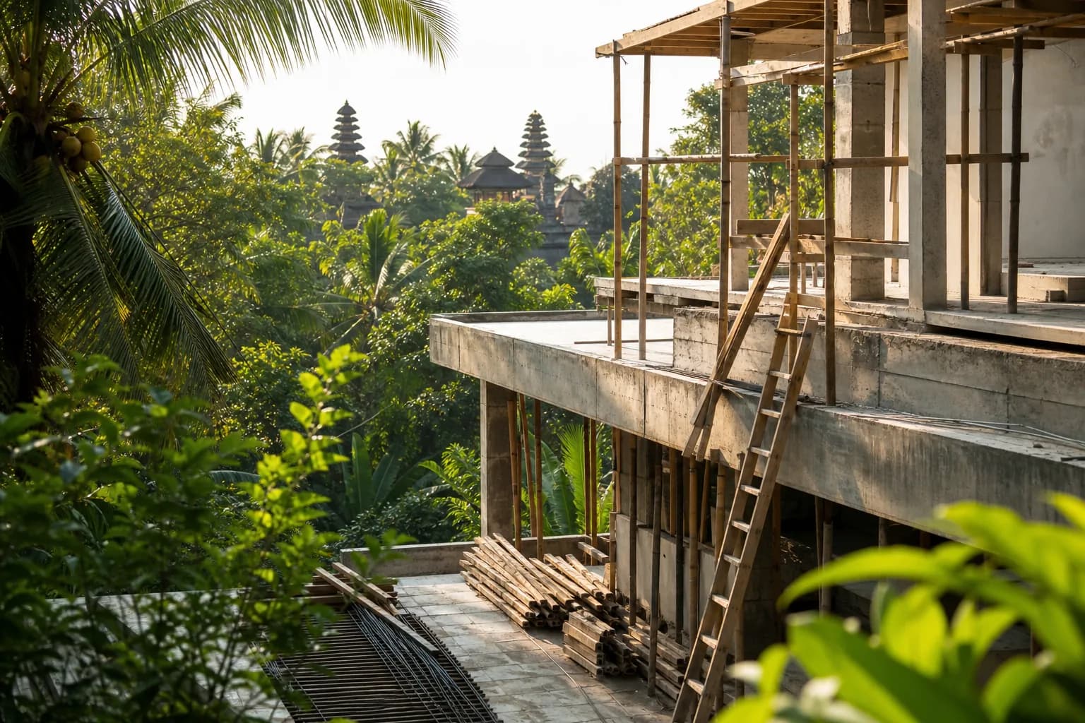
Mengwi Temple, specifically Pura Taman Ayun—a UNESCO World Heritage Site and one of Bali’s most significant royal temples—sits at the center of complex spatial planning regulations that directly impact construction feasibility within its surrounding zones. While recent provincial announcements focus on broader agricultural land protection and tourism infrastructure, the legal framework governing construction near major temples like Mengwi predates these initiatives and operates through layered regulatory mechanisms that many foreign buyers and even local developers fail to fully comprehend until permit applications are rejected.
The critical issue isn’t whether new bans exist—it’s that existing buffer zone regulations around Mengwi Temple remain poorly documented in English-language resources, inconsistently enforced across different banjar (village councils), and subject to interpretation by multiple overlapping authorities including the Badung Regency spatial planning office, the Bali Provincial Cultural Heritage Agency (BPCB), and local adat (customary law) councils. This regulatory ambiguity creates significant construction risk for land purchases within approximately 2-5 kilometers of Pura Taman Ayun’s outer walls, where projects may face unexpected permit denials, mandatory design modifications, or construction halts after foundation work has already commenced.
Technical Framework: Sacred Radius Regulations and Spatial Planning Overlays
Bali’s temple proximity regulations operate through three distinct but overlapping legal frameworks. First, the Provincial Regulation (Perda) No. 16/2009 on Bali Spatial Planning (RTRW) establishes general protected zones around major cultural sites, though specific radius measurements are delegated to regency-level implementation. Second, the Cultural Heritage Law (UU No. 11/2010) mandates buffer zones around nationally recognized heritage sites—which includes Pura Taman Ayun as part of the Subak UNESCO inscription. Third, and often most restrictive, are the adat village regulations (awig-awig) that govern land use within traditional village boundaries, which frequently extend well beyond statutory buffer zones.
For Mengwi Temple specifically, the technical challenge lies in the compound’s classification as both a state temple (Pura Kawiten) and a UNESCO component site. This dual status triggers multiple regulatory layers. The Cultural Heritage Law theoretically requires a minimum 50-meter physical buffer plus an additional “environmental buffer” that spatial planning offices typically interpret as 200-500 meters depending on topography and sightlines. However, the Mengwi traditional village (Desa Adat Mengwi) maintains customary regulations that extend sacred space considerations up to 2 kilometers in certain directions, particularly along the temple’s primary ceremonial axis.
From an engineering perspective, the most significant construction restrictions within these zones include: height limitations (typically 15 meters maximum, equivalent to a coconut tree or approximately 4 stories), building footprint restrictions (often limiting site coverage to 20-30% rather than the standard 40%), mandatory architectural style compliance requiring traditional Balinese roof forms and material palettes, and prohibition of certain building functions deemed incompatible with sacred space—particularly entertainment venues, alcohol-serving establishments, and in some interpretations, short-term rental villas.
The spatial planning overlay system adds further complexity. Mengwi sits within Zone KSA (Kawasan Strategis Adat—Strategic Customary Area) under Badung’s detailed spatial plan, which imposes additional review requirements beyond standard IMB (building permit) procedures. Any construction within KSA zones requires a separate Cultural Impact Assessment (Kajian Dampak Budaya) prepared by certified assessors and reviewed by the regency’s cultural affairs office—a process that typically adds 3-6 months to permit timelines and costs USD $2,000-5,000 depending on project scale.
What makes Mengwi particularly challenging compared to other temple proximity situations is the temple’s role as the historical seat of the Mengwi Kingdom. This royal heritage means that certain land parcels within the broader area carry historical designations (tanah pekarangan puri—palace grounds) that may not appear on standard land certificates but emerge during the permit review process when historical land use maps are cross-referenced. We’ve documented cases where land marketed as “clear for construction” was later found to sit on former palace irrigation channels (telabah puri), triggering automatic construction prohibitions regardless of current land certificate status.
Hidden Risks: What Due Diligence Processes Miss
The most dangerous assumption buyers make is that a clean land certificate (SHM or Hak Pakai) guarantees construction rights near Mengwi Temple. Land certification processes verify ownership and basic zoning compliance, but they don’t cross-reference against temple buffer zones, adat village spatial plans, or UNESCO heritage site management plans. We’ve reviewed multiple cases where foreign buyers purchased certified land within 1.5 kilometers of Pura Taman Ayun, obtained positive preliminary assessments from notaries, only to have IMB applications rejected due to conflicts with the temple’s “spiritual viewshed”—a concept that doesn’t appear in statutory law but is enforced through the Cultural Impact Assessment process.
Another critical gap: the difference between banjar administrative boundaries and desa adat customary territories. A land parcel may sit in Banjar Mengwi administratively (where you pay local taxes and obtain recommendation letters) but fall under Desa Adat Sempidi’s customary jurisdiction for construction approval purposes. Since each desa adat maintains its own interpretation of appropriate buffer distances and architectural requirements around major temples, this jurisdictional confusion can derail projects that have already secured administrative approvals from the “wrong” village council.
The temporal risk factor is equally significant. Temple buffer zone enforcement intensity fluctuates based on political cycles, tourism pressure, and high-profile violations. Following the 2023 crackdown on illegal beachfront construction in Canggu, cultural heritage enforcement around major temples intensified significantly. Projects that might have received tacit approval in 2021-2022 now face stricter scrutiny. This enforcement variability means that precedent—”my neighbor built a three-story villa, so I can too”—provides no legal protection and often leads to expensive mid-construction modifications or demolition orders.
Step-by-Step Verification Process for Mengwi Temple Proximity Sites
Phase 1: Multi-Layer Spatial Analysis (Before Land Purchase)
Begin with precise GPS coordinate documentation of the land parcel boundaries, then conduct radius analysis from Pura Taman Ayun’s main gate (coordinates: -8.5558° S, 115.1697° E). Map three concentric zones: 0-500m (high restriction probability), 500-2000m (moderate restriction, case-dependent), 2000m+ (lower risk but still subject to viewshed analysis). Cross-reference these zones against the Badung Regency RTRW map available at the spatial planning office (Dinas PUPR Badung) to identify any KSA overlay designations.
Simultaneously, obtain written confirmation from the relevant desa adat regarding customary land use restrictions. This requires a formal letter request (in Indonesian) to the Bendesa Adat (customary village head) specifying the exact land parcel and intended use. Critical detail: request specific reference to any awig-awig provisions related to temple proximity construction. This document should be obtained before signing any land purchase agreement, as it’s not typically included in standard notary due diligence packages.
Phase 2: Heritage Impact Pre-Assessment
Engage a certified Cultural Impact Assessment consultant before finalizing land purchase. While the full Kajian Dampak Budaya is only required during permit application, a preliminary assessment (typically USD $800-1,200) can identify fatal flaws early. The consultant should specifically evaluate: direct sightlines from temple courtyards to the proposed construction site, alignment with ceremonial procession routes (which may cross private land during major festivals), and any historical land use designations in provincial archives.
Request the consultant to review the UNESCO Subak Cultural Landscape management plan, which includes specific provisions for the Mengwi area. While this document is primarily focused on irrigation systems, it contains spatial guidelines that the Cultural Heritage Agency references during permit reviews. Projects that conflict with Subak system preservation—even tangentially—face significantly higher rejection risk.
Phase 3: Integrated Permit Strategy Development
Develop architectural concepts that proactively address likely restrictions rather than designing first and modifying later. For Mengwi proximity sites, this means: limiting building height to 12 meters (below the typical 15m threshold to provide buffer), incorporating traditional Balinese roof forms from initial design (not as afterthought), planning for 25% maximum site coverage, and positioning buildings to minimize visibility from temple approach roads.
Prepare a comprehensive permit application package that includes the Cultural Impact Assessment, desa adat recommendation letter, environmental impact analysis (UKL-UPL or AMDAL depending on project scale), and detailed architectural drawings showing compliance with traditional design principles. Submit this integrated package to the Badung One-Stop Investment and Integrated Services Office (DPMPTSP) with explicit reference to the temple proximity considerations—this demonstrates proactive compliance and typically results in faster review compared to applications that trigger these issues during the review process.
Realistic Cost and Timeline Implications
Temple proximity construction in the Mengwi area carries specific cost premiums and timeline extensions that must be factored into project feasibility analysis. The Cultural Impact Assessment adds USD $2,000-5,000 to pre-construction costs, while specialized consultants familiar with Mengwi’s specific regulatory environment charge USD $1,500-3,000 for permit facilitation services beyond standard architectural fees.
Architectural modifications to meet traditional design requirements typically increase construction costs by 8-15% compared to contemporary villa designs. Traditional Balinese roof structures using alang-alang (thatched grass) or sirap (wooden shingles) cost USD $85-140 per square meter versus USD $45-65 for standard concrete tile roofing. Carved stone elements required for culturally compliant facades add USD $3,000-8,000 depending on detail level and stone quality.
Timeline extensions are substantial: standard IMB processing in Badung takes 14-21 days for straightforward applications, but temple proximity sites requiring Cultural Impact Assessment review typically extend this to 90-120 days. If the initial assessment identifies concerns requiring design modifications and resubmission, total permit timeline can reach 6-8 months. Factor an additional 30-45 days for desa adat consultation and recommendation letter procurement, which must precede formal permit application.
For context, a standard 250-square-meter two-bedroom villa on non-restricted land in Badung might achieve permit-to-completion in 8-10 months with construction costs of USD $1,400-1,800 per square meter. The same project within 1.5 kilometers of Mengwi Temple typically requires 12-14 months total timeline and USD $1,650-2,100 per square meter due to design modifications, extended permit processing, and specialized compliance requirements.
Frequently Asked Questions: Mengwi Temple Construction Restrictions
How do I determine if specific land near Mengwi Temple is subject to construction restrictions?
Definitive determination requires three parallel verification processes: obtain a spatial planning statement (Keterangan Rencana Kota/KRK) from the Badung spatial planning office specifying any KSA overlay zones; request written confirmation from the relevant desa adat regarding customary restrictions; and commission a preliminary Cultural Impact Assessment from a certified consultant. Standard land certificates and notary due diligence do not include temple proximity analysis, so these additional steps are essential. The spatial planning statement costs approximately USD $50-80 and takes 7-14 days; desa adat confirmation is typically free but requires 2-4 weeks; preliminary heritage assessment costs USD $800-1,200. All three should be completed before signing land purchase agreements.
Can I build a rental villa within 2 kilometers of Pura Taman Ayun?
Possibly, but with significant restrictions and higher rejection risk compared to primary residences. The key issue is that short-term rental villas are increasingly classified as commercial tourism accommodation, which faces stricter scrutiny in temple proximity zones. Some desa adat in the Mengwi area have implemented explicit prohibitions on new tourism accommodation within their customary territories, while others evaluate applications case-by-case. Your project would require: Cultural Impact Assessment demonstrating no negative impact on temple sanctity, desa adat recommendation letter explicitly approving tourism use, compliance with traditional architectural standards, and likely restrictions on guest activities (no loud events, alcohol service limitations, modest dress code enforcement). Even with approvals, expect 25-40% longer permit timelines and potential operational restrictions that impact rental viability. Review villa concepts designed for culturally sensitive areas to understand compliant design approaches.
What happens if I start construction without proper temple proximity clearances?
Construction without proper Cultural Impact Assessment and desa adat approvals in temple proximity zones can result in: immediate stop-work orders (Surat Perintah Penghentian Pekerjaan) issued by the regency public works office, administrative fines of IDR 50-250 million (USD $3,000-15,000), mandatory demolition of non-compliant structures, and blacklisting from future permit applications in Badung Regency. More significantly, desa adat councils c
 4344 m²16 month(s)from 290.000 USD
Radha
 164 m²7 month(s)from 79.000 USD
Private: Haridas Villas, Tegallalang
 3127 m²9 month(s)from 177.000 USD
Mukunda
 1from 198.000 USD
Private: Haridas Villas

Want to calculate?
 2144 m²11 month(s)from 104.000 USD
Narayana
 3180 m²7 month(s)from 142.000 USD
Vasudeva
 172 m²8 month(s)from 120.000 USD
Keshava
 3173 m²6 month(s)from 125.000 USD
TALA FOUR
164 m²7 month(s)from 79.000 USDTALA TWO
 3104 m²11 month(s)from 99.000 USD
TALA 100
 3124 m²6 month(s)from 123.000 USD
TALA 8
Start With Real Numbers, Not Guesses
Before buying land or finalizing a design, check the realistic build cost range for your project in Bali.
Our team reviews your inputs and gives a grounded estimate.
Available lands
 13000 m²1 min$ 920567Bali, Pekutatan
 1000 m²10 min$ 230911Bali, Kerobokan
 2230 m²15 min$ 410573Bali, Padonan
 2130 m²10 min$ 495776Bali, Pecatu
 550 m²15 min$ 164594Bali, Mengwi
 2200 m²15 min$ 508005Bali, Canggu
 700 m²15 min$ 90517Bali, Central Bali
 204 m²5 min$ 40899Bali, Kedungu
 1533 m²5 min$ 165666Bali, Cepaka
 2680 m²10 min$ 1732759Bali, Pererenan
 2850 m²15 min$ 315887Bali, Tabanan
 1362 m²15 min$ 335468Bali, Tumbak
 585 m²8 min$ 165702Bali, Mengwi
 18900 m²2 min$ 6912931Bali, Pecatu
 2000 m²15 min$ 110837Bali, Karangasem
Planning a build in Bali?
Get a feasibility view, budget range and timeline from Teville.
Related guides

Concealed HVAC Duct Sealing QA Finish Repair Protocols Bali
Expert technical guide: Concealed HVAC Duct Sealing QA Finish Repair Protocols Bali
8 min read
Soft-Close Kitchen Hinge Failures in Bali: Quality Issues
Discover why modular kitchen cabinet soft-close hinges fail in Bali. Learn about quality risks, durability issues, and solutions for homeowners.
10 min read
Built-In Wardrobe Installation Termite Protection in Bali
Learn effective termite protection methods for custom built-in wardrobes in Bali. Expert installation tips to safeguard your furniture from pest damage.
10 min read