Tabanan Rice Terrace View Corridors: Height Permits Costs Bali
The Tabanan Rice Terrace View Corridor Compliance Challenge
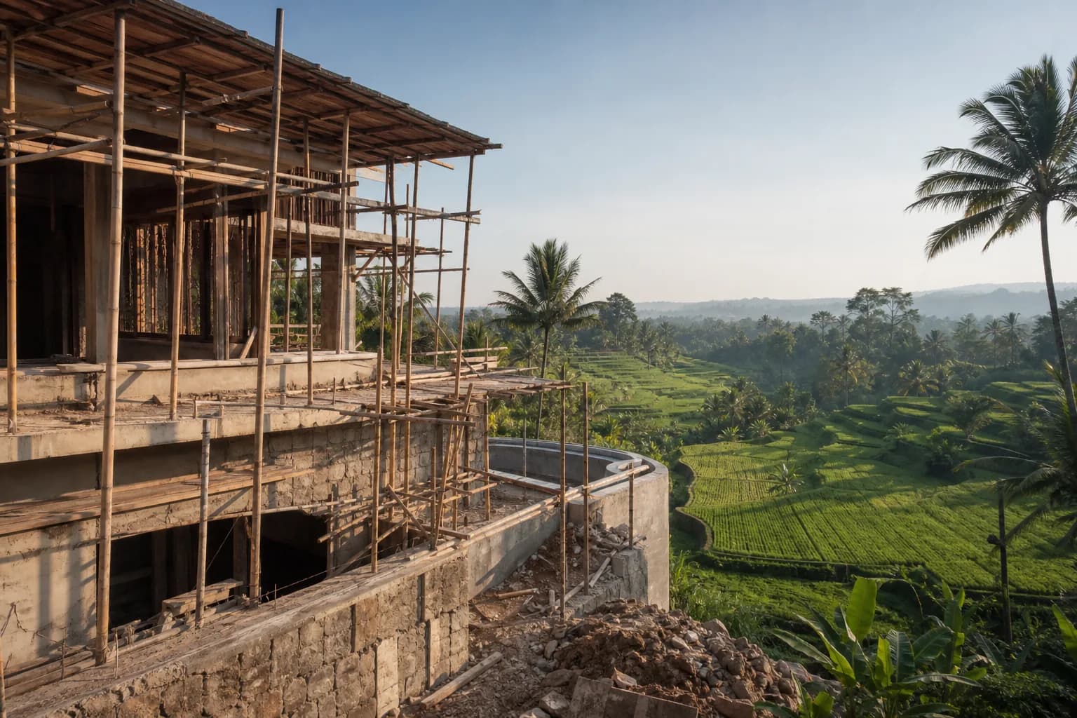
Building within sight of Tabanan’s UNESCO-recognized rice terraces presents a unique regulatory challenge that most foreign buyers discover too late: Bali’s spatial planning laws impose strict height restrictions and view corridor protections that can fundamentally alter your construction budget and design feasibility. Unlike generic building permits, projects within designated view corridors require additional environmental impact assessments, cultural heritage compliance documentation, and specialized height restriction permits that can add 4-8 months to your timeline and IDR 75-180 million to your total project costs. The technical complexity lies not in the construction itself, but in navigating the intersection of provincial spatial planning regulations (RTRW), regency-specific detailed spatial plans (RDTR), and traditional village (desa adat) customary restrictions that often impose stricter limits than government regulations. For construction companies operating in Tabanan’s Jatiluwih, Belimbing, and Penebel districts, understanding these layered compliance requirements before land acquisition prevents costly design revisions and permit rejections that can derail entire projects.
Technical Framework: Height Restrictions and View Corridor Regulations in Tabanan
Tabanan’s rice terrace view corridors are governed by three overlapping regulatory frameworks that create a complex compliance matrix. The provincial RTRW Bali 2009-2029 designates rice terrace landscapes as “kawasan lindung” (protected zones) with baseline height restrictions, while the Tabanan Regency RDTR 2013-2033 provides district-specific implementation details. The third layer—often the most restrictive—comes from desa adat regulations that protect sacred view lines to temples and ceremonial sites.
Regulatory Height Thresholds by Zone Classification
Within Tabanan’s designated rice terrace view corridors, height restrictions typically follow this technical hierarchy:
- Primary View Corridor Zones (within 200m of terraces): Maximum building height 8-10 meters from natural ground level, measured to roof ridge. This translates to single-story construction with limited mezzanine options. The measurement methodology is critical—ground level is determined by pre-construction topographic surveys, not post-excavation levels.
- Secondary Buffer Zones (200-500m from terraces): Maximum height 12-15 meters, permitting two-story construction with specific roof profile requirements. Pitched roofs with traditional Balinese architectural elements often receive more favorable review than flat contemporary designs.
- Tertiary Development Zones (500m+ from terraces): Standard regency height limits apply (typically 15-18 meters), but view impact assessments may still be required if the structure is visible from designated viewpoints.
The engineering challenge intensifies on sloped terrain. A building on a hillside may comply with height restrictions when measured from the uphill side but violate them when measured from the downhill perspective. Tabanan’s planning authorities use the “average natural ground level” methodology, requiring detailed topographic surveys with minimum 1-meter contour intervals across the entire building footprint plus a 10-meter perimeter buffer.
Permit Requirements Beyond Standard PBG
Standard building permits (PBG – Persetujuan Bangunan Gedung) are insufficient for view corridor projects. Additional documentation includes:
- AMDAL or UKL-UPL: Environmental impact assessment documents required for projects within 300 meters of protected rice terraces. AMDAL (full assessment) applies to projects exceeding 5,000 square meters or involving significant terrain modification. Smaller projects require UKL-UPL (environmental management and monitoring plans).
- Rekomendasi Desa Adat: Formal recommendation from the traditional village council, which often imposes additional restrictions on building orientation, material visibility, and construction timing to avoid ceremonial periods. This is not a rubber-stamp process—desa adat can reject projects that comply with government regulations but violate customary view protection principles.
- Surat Keterangan Rencana Kota (SKRK): Urban planning certificate that confirms your proposed building height and design comply with the specific RDTR zone classification for your plot. This document must be obtained before PBG application and requires architectural drawings showing all elevations with height measurements from natural ground level.
- Izin Lingkungan: Environmental permit that addresses water runoff management, rice field irrigation impact, and soil erosion prevention—critical in terrace landscapes where construction can disrupt centuries-old water distribution systems.
The technical review process examines sight lines from designated public viewpoints. Tabanan maintains a registry of protected viewpoints along major roads and tourist routes. Your architectural drawings must include sight line analysis showing that your structure does not break the visual horizon when viewed from these specific coordinates. This requires professional surveying equipment and CAD modeling—hand-drawn estimates are rejected.
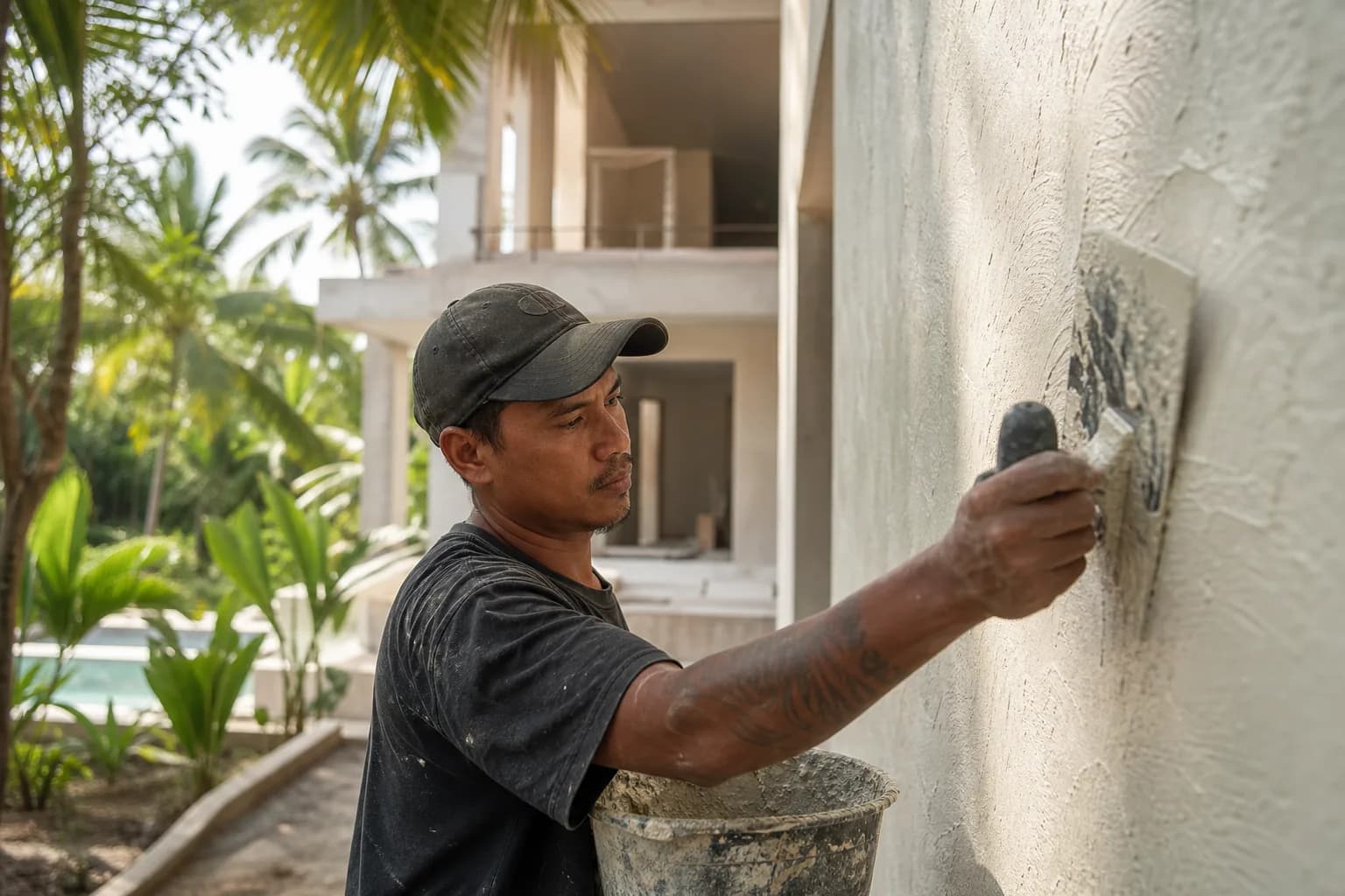
Material and Design Compliance Requirements
Height restrictions are only one component. View corridor regulations also govern:
- Roof profiles: Minimum pitch angles (typically 30-35 degrees) to maintain traditional landscape character. Flat roofs are generally prohibited in primary view corridors.
- Exterior materials: Restrictions on reflective surfaces, bright colors, and modern materials that create visual disruption. Natural stone, timber cladding, and earth-tone finishes receive preferential approval.
- Setback multipliers: Standard setbacks (typically 5-8 meters from boundaries) may be increased by 1.5-2x in view corridor zones to reduce visual mass.
Hidden Risks: What Foreign Buyers Miss in Tabanan View Corridor Projects
The most expensive mistakes occur during land acquisition, before construction even begins. Many buyers purchase land based on generic zoning classifications without understanding view corridor overlay restrictions. A plot classified as “residential zone” in the RDTR may still fall within a protected view corridor that imposes height limits incompatible with the buyer’s villa design expectations.
The Measurement Methodology Trap
Height measurements in Tabanan’s view corridors use “natural ground level” as the baseline, but determining this level after site clearing or excavation is contentious. Buyers who excavate for foundations before obtaining height verification from planning authorities risk having their measurements calculated from the original pre-construction topography, effectively reducing their allowable building height by the excavation depth. Professional practice requires a certified topographic survey before any site work, with benchmark monuments installed and photographed to establish the legal measurement baseline.
The Desa Adat Variable
Government permits provide legal authorization, but desa adat approval determines practical feasibility. Traditional villages in Tabanan’s rice terrace regions maintain customary restrictions that can be more stringent than government regulations. A desa adat may approve your project but require that construction pause during Galungan, Kuningan, and other ceremonial periods—adding 30-45 days to your construction timeline. Some villages prohibit construction activities during rice planting and harvest seasons to avoid disrupting agricultural water flows. These restrictions are not documented in government regulations but are enforced through community pressure and can result in work stoppages if ignored.
The Cumulative Impact Assessment Risk
Individual projects may comply with height restrictions, but Tabanan planning authorities increasingly apply cumulative impact analysis in popular view corridor areas. If multiple projects in the same viewshed collectively degrade the landscape character, authorities may impose temporary development moratoria or require existing permit holders to modify approved designs. This risk is highest in Jatiluwih and Belimbing, where tourism development pressure is intense. Buyers should request documentation of other approved projects within a 500-meter radius and assess cumulative visual impact before committing to land purchase.
Step-by-Step Process: Securing Height Restriction Permits in Tabanan View Corridors
Phase 1: Pre-Acquisition Due Diligence (4-6 Weeks)
Step 1: Obtain the official RDTR map for your specific district from the Tabanan Regency Spatial Planning Office (Dinas Penataan Ruang). Request the digital GIS file, not just a printed map, to verify exact zone boundaries. Your land coordinates must be plotted with GPS precision—boundary ambiguities are common in rural areas.
Step 2: Commission a professional topographic survey with minimum 1-meter contour intervals. The survey must extend 50 meters beyond your property boundaries to document surrounding terrain and identify potential sight line conflicts. Cost: IDR 8-15 million for a standard 1,000-2,000 sqm plot.
Step 3: Engage a local architect experienced in Tabanan view corridor projects to conduct a preliminary design feasibility study. This study should model your desired building program against height restrictions and produce sight line analysis from known protected viewpoints. Cost: IDR 15-25 million for feasibility study.
Step 4: Meet with desa adat leadership to present your preliminary concept and understand customary restrictions. Bring a Balinese-speaking consultant—these discussions require cultural fluency and relationship-building that foreign buyers cannot navigate independently. Document all verbal restrictions in writing and have them confirmed by the kelian adat (traditional village head).
Phase 2: Formal Permit Application (3-5 Months)
Step 5: Apply for SKRK (urban planning certificate) at the Tabanan Regency One-Stop Investment and Integrated Services Office (DPMPTSP). Required documents include land certificates, topographic survey, preliminary architectural drawings showing all elevations with height measurements, and site photographs from multiple angles. Processing time: 14-21 working days if complete; rejections for incomplete documentation add 3-4 weeks per resubmission cycle.
Step 6: Prepare environmental documents (AMDAL or UKL-UPL) through a certified environmental consultant. This process includes soil testing, water impact analysis, and biodiversity assessment. For UKL-UPL (most common for residential projects): 6-8 weeks preparation, IDR 35-60 million cost. For full AMDAL: 3-4 months preparation, IDR 120-200 million cost.
Step 7: Submit PBG application with all supporting documents: SKRK, environmental permits, desa adat recommendation letter, detailed architectural and structural drawings, and IMB (building permit) from the previous regulatory framework if applicable. The PBG review process includes site inspection by planning officials who verify that your drawings accurately represent site conditions and that height measurements are calculated from the correct baseline. Processing time: 30-45 working days after complete submission.
Phase 3: Construction Compliance (Ongoing)
Step 8: Install permanent height verification markers at building corners before foundation work begins. These markers, certified by a licensed surveyor, provide the legal reference points for height compliance inspections during construction. Inspectors will measure from these markers to verify that your structure does not exceed permitted heights.
Step 9: Schedule mandatory progress inspections at foundation completion, structural frame completion, and roof installation. Each inspection must confirm height compliance before proceeding to the next construction phase. Inspectors use laser measuring equipment and compare actual heights to approved drawings—deviations exceeding 10 centimeters trigger compliance reviews.
Step 10: Obtain SLF (Certificate of Proper Functioning) after construction completion. This requires final inspection confirming that the as-built structure matches approved permits, including height restrictions. SLF is legally required before occupancy and is increasingly enforced in view corridor zones where violations are visually obvious.
Realistic Cost and Timeline Ranges for Tabanan View Corridor Projects
Permit and Compliance Costs (2026 Estimates)
- Topographic survey with height verification: IDR 8-15 million (1,000-2,000 sqm plot)
- Architectural feasibility study with sight line analysis: IDR 15-25 million
- SKRK (urban planning certificate): IDR 2-4 million (official fees) + IDR 8-12 million (consultant processing)
- UKL-UPL environmental documents: IDR 35-60 million
- AMDAL (if required for larger projects): IDR 120-200 million
- Desa adat consultation and ceremonial contributions: IDR 10-25 million (varies by village and project scale)
- PBG (building permit) for view corridor project: IDR 15-30 million (official fees based on building value) + IDR 20-35 million (consultant processing)
- Construction phase inspections and compliance verification: IDR 12-20 million
- SLF (Certificate of Proper Functioning): IDR 8-15 million
Total additional compliance costs for view corridor projects: IDR 75-180 million beyond standard construction permits, depending on project complexity and environmental assessment requirements.
Timeline Implications
View corridor compliance adds 4-8 months to standard project timelines:
Our team reviews your inputs and gives a grounded estimate.
Available lands
 7250 m²56 min$ 235714Bali, Tabanan
 700 m²20 min$ 90517Bali, Cepaka
 1200 m²2 min$ 155172Bali, Klungkung
 1000 m²10 min$ 184729Bali, Kutuh South Bali
 2000 m²15 min$ 110837Bali, Karangasem
 600 m²12 min$ 101970Bali, Mengwi
 500 m²10 min$ 107143Bali, Tabanan
 5000 m²8 min$ 424877Bali, Ungasan
 1000 m²10 min$ 280788Bali, Pecatu
 3100 m²20 min$ 272968Bali, Tabanan
 1158 m²12 min$ 291996Bali, Mengwi
 610 m²10 min$ 165271Bali, Seminyak
 7900 m²25 min$ 413485Bali, Tabanan
 889 m²15 min$ 145612Bali, Cepaka
 2000 m²15 min$ 261700Bali, Babakan
Planning a build in Bali?
Get a feasibility view, budget range and timeline from Teville.
Related guides
Resin-Infused Plaster Finishes: Anti-Salt Systems Bali
Expert technical guide: Resin-Infused Plaster Finishes: Anti-Salt Systems Bali
8 min read
Prefinished Timber Joinery: Silicone Seals Fixings Bali
Professional prefinished timber joinery installation in Bali with silicone seals and fixings for durable weatherproof performance and a premium finish.
10 min read
Polished Concrete Microtopping: Surface Prep Sealants Bali
Discover Bali s polished concrete microtopping: expert surface prep, durable sealants, and a flawless finish for modern floors with minimal maintenance.
9 min read