Sanur Coastal Setback Rules: Beachfront Construction Limits Bali
The Sanur Beachfront Construction Dilemma: Understanding Coastal Setback Enforcement
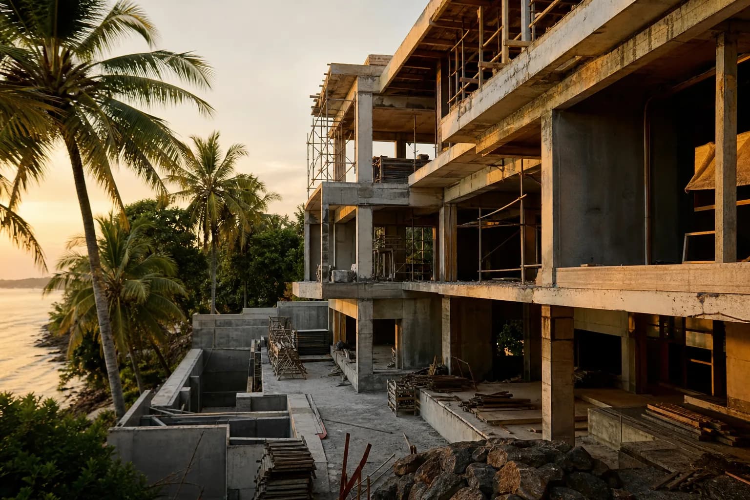
Sanur’s beachfront properties represent some of Bali’s most desirable construction sites, yet many prospective villa developers discover too late that their planned oceanfront structure violates Indonesia’s coastal setback regulations. Unlike Bali’s southern cliffs or inland rice terraces, Sanur’s flat coastal topography places nearly every beachfront parcel within the regulated sempadan pantai zone—the mandatory buffer between construction and the high-tide line. As of 2026, Bali’s provincial government has intensified enforcement of these setback rules, with new legislation specifically targeting illegal coastal construction and public beach access obstruction. For construction companies like Teville, this means every Sanur beachfront project now requires forensic-level site analysis before foundation work begins, as setback violations can result in demolition orders, regardless of permit status.
Technical Framework: Sanur’s Coastal Setback Regulations and Construction Boundaries
Indonesia’s coastal setback law (sempadan pantai) establishes construction-free zones measured from the highest tide line, but Sanur’s implementation involves multiple overlapping regulatory frameworks that create complex compliance requirements. The foundational regulation stems from Presidential Decree No. 51/2016, which mandates minimum setbacks ranging from 50 to 100 meters depending on coastal morphology, wave exposure, and ecological sensitivity.
Sanur-Specific Setback Measurements
Sanur’s eastern coastline falls under the “sheltered beach with reef protection” classification, which theoretically allows the minimum 50-meter setback from the high-tide line. However, Denpasar City’s local spatial planning regulations (RTRW) impose additional restrictions that effectively extend this buffer zone. The critical measurement point—the “highest tide line”—requires certified surveyor documentation using tidal data from BMKG (Indonesia’s meteorology agency), not visual estimation or property boundary assumptions.
The engineering challenge: Sanur’s beach profile changes seasonally. During the northwest monsoon (November-March), wave action and tidal patterns shift the effective high-tide line landward by 3-8 meters compared to dry season measurements. Construction permits require setback calculations based on the maximum recorded high-tide position over a 10-year period, meaning a site that appears to have 55 meters of clearance during dry season surveys may actually have only 47 meters during monsoon conditions—placing it in violation.
Layered Regulatory Compliance Requirements
Sanur beachfront construction must satisfy four distinct regulatory layers simultaneously. First, the national coastal setback law establishes the baseline 50-meter minimum. Second, Denpasar’s RTRW adds zone-specific restrictions—Sanur’s tourism zone designation includes additional public access requirements. Third, environmental impact assessment (AMDAL or UKL-UPL) regulations apply to any construction within 100 meters of the coastline, requiring separate environmental clearance before building permits issue. Fourth, the 2026 beach access protection law prohibits any structure that obstructs traditional public pathways to the beach, even if the structure itself complies with setback measurements.
From a construction engineering perspective, these regulations create a practical building envelope that’s significantly smaller than the legal land boundary. A typical 1,000-square-meter beachfront plot in Sanur might have only 400-600 square meters of buildable area after setback compliance, access pathway preservation, and side/rear boundary setbacks are applied. This dramatically affects foundation planning, utility routing, and site drainage design.
The 2026 Enforcement Shift
Recent legislative changes have transformed coastal setback rules from loosely enforced guidelines to strictly monitored legal boundaries. The new beach access protection law empowers local communities to report violations directly to provincial authorities, bypassing municipal-level discretion that previously allowed negotiated compliance. Enforcement now includes satellite monitoring—Bali’s spatial planning agency (Bappeda) uses quarterly satellite imagery analysis to identify new coastal construction, cross-referencing structures against permitted building locations.
For construction companies, this means setback compliance must be demonstrable through surveyed documentation, not just permit approval. Teville’s approach involves commissioning independent geodetic surveys that establish the high-tide line using certified tidal data, then applying the full 50-meter setback plus a 5-meter safety buffer before designing foundation layouts. This conservative methodology prevents situations where technically compliant permits later face enforcement action due to measurement disputes.
Hidden Risks: What Sanur Beachfront Buyers and Developers Overlook
The most dangerous assumption in Sanur coastal construction is that existing neighboring structures indicate permissible building locations. Many established beachfront properties in Sanur were constructed before 2016’s coastal setback law took effect, or received permits during periods of lax enforcement. These “grandfathered” structures do not establish precedent for new construction—recent projects face full compliance requirements regardless of surrounding development patterns.
The Permit Approval Trap
Securing an IMB (building permit) does not guarantee setback compliance. Indonesia’s permitting system involves multiple agencies with limited inter-agency verification. A municipal building department may issue an IMB based on submitted site plans without independently verifying coastal setback measurements against certified tidal surveys. When provincial environmental authorities later conduct compliance audits, they apply their own measurement standards—frequently resulting in violations despite valid permits. Teville has documented cases where IMB-approved foundations were ordered demolished because the permit approval process failed to catch setback violations that environmental auditors later identified.
Erosion and Dynamic Coastline Risk
Sanur’s coastline experiences measurable erosion rates of 0.5-1.2 meters annually in certain segments, particularly north of Sindhu Beach. A structure built exactly at the 50-meter setback line today may be only 45 meters from the high-tide line within five years due to natural coastal retreat. The regulations contain no provision for erosion-adjusted setbacks—the 50-meter minimum applies to the current high-tide line, meaning structures can fall into violation through no action of the owner. Engineering risk management requires building significantly beyond the minimum setback to account for projected 20-year erosion scenarios.
Public Access Pathway Complications
The 2026 beach access law requires preservation of traditional pathways (jalan setapak) that local communities have historically used to reach the beach. These pathways often don’t appear on cadastral maps or land certificates. During construction, community groups may assert traditional access rights through property that the owner believed was fully private. Resolution requires negotiating formal access easements, which can bisect planned building locations and require complete foundation redesigns mid-project.
Step-by-Step Process: Navigating Sanur Coastal Construction Compliance
Phase 1: Pre-Acquisition Coastal Assessment (3-4 Weeks)
Before purchasing Sanur beachfront land, commission a certified geodetic survey that establishes the legal high-tide line using 10-year tidal data from BMKG. This survey must be conducted by a surveyor licensed for coastal boundary work (not standard land surveyors). The survey report should include GPS coordinates of the high-tide line, calculated setback boundary, and buildable area polygon overlaid on the property boundaries. Cost: $800-1,200 for professional coastal survey.
Simultaneously, request a spatial planning compliance letter (Surat Keterangan Rencana Kota/SKRK) from Denpasar’s spatial planning office. This document confirms the property’s zoning designation and lists all applicable construction restrictions, including any Sanur-specific coastal regulations beyond the national 50-meter standard. Processing time: 14-21 days with complete documentation.
Phase 2: Community Access Verification (2-3 Weeks)
Engage a local facilitator to conduct community consultations with the banjar (neighborhood association) and traditional fishing communities. Document any claimed traditional access pathways through the property. If pathways exist, negotiate formal access easement agreements before finalizing land purchase. This prevents mid-construction disputes that can halt work for months. Teville includes this community verification in all Sanur coastal projects as standard risk mitigation.
Phase 3: Environmental Clearance Application (8-12 Weeks)
For any construction within 100 meters of Sanur’s coastline, environmental clearance (UKL-UPL for smaller projects, full AMDAL for developments over 5,000 square meters) must be obtained before building permit applications. This process requires environmental impact documentation covering drainage, wastewater management, construction-phase erosion control, and coastal ecosystem protection measures. The application must demonstrate that construction will not accelerate coastal erosion or damage coral reef ecosystems offshore.
Engineering specifications required: foundation design that prevents groundwater contamination, stormwater management system that doesn’t discharge directly to beach, construction methodology that contains sediment runoff. Processing time varies significantly—UKL-UPL typically requires 8-10 weeks; full AMDAL can extend to 16-20 weeks with revisions.
Phase 4: Setback-Compliant Design and IMB Application (6-8 Weeks)
Architectural and structural designs must incorporate the surveyed setback boundary as an absolute constraint. Foundation plans should include the geodetic survey as a reference document, with all structural elements clearly dimensioned from the established high-tide line. The IMB application package must include the coastal survey, environmental clearance, and community access agreements (if applicable). Denpasar’s building department requires additional review time for coastal properties—expect 6-8 weeks versus 4-5 weeks for inland sites.
Phase 5: Construction with Compliance Monitoring (Variable Duration)
During construction, maintain the geodetic survey markers and conduct periodic verification measurements to ensure foundation work remains within approved boundaries. Bali’s increasing use of satellite monitoring means any deviation from permitted building footprints may trigger inspection visits. Document all construction phases photographically with GPS-tagged images showing setback compliance throughout the build process.
Realistic Cost and Timeline Implications for Sanur Coastal Projects
Coastal setback compliance adds measurable costs and timeline extensions compared to inland Bali construction. Pre-construction compliance work (coastal surveys, environmental clearances, community consultations) typically adds $3,500-6,000 to project budgets and extends pre-construction timelines by 12-16 weeks beyond standard land development projects.
Design Efficiency Impacts
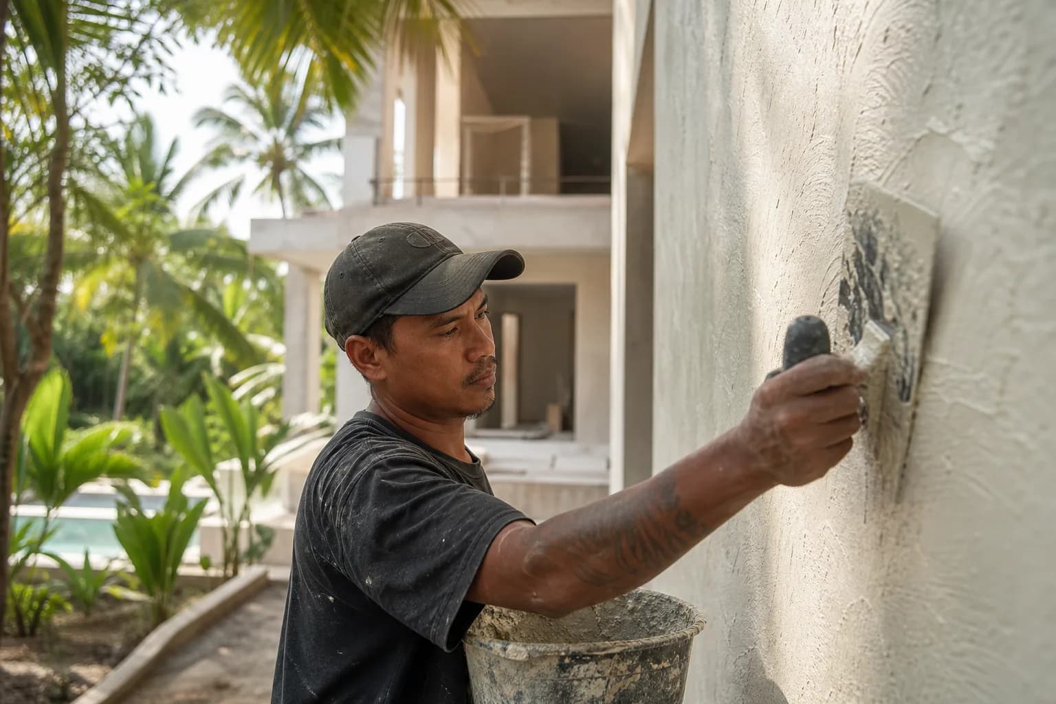
The reduced buildable envelope on Sanur beachfront plots requires more efficient architectural design to achieve desired living space. Multi-story construction becomes necessary where single-story layouts would be feasible on inland plots. This increases structural engineering costs by 15-20% due to more complex foundation requirements in coastal soil conditions and additional lateral load calculations for taller structures in the coastal wind environment.
A typical 300-square-meter villa that might cost $185,000-210,000 to construct inland will cost $215,000-245,000 on a setback-compliant Sanur beachfront site due to these design constraints, more complex foundations in sandy coastal soils, and enhanced corrosion protection for structural elements in the salt-air environment.
Timeline Realities
Total timeline from land acquisition to construction completion for Sanur coastal projects: 16-20 months, compared to 12-14 months for comparable inland projects. The difference stems primarily from extended permitting (environmental clearance adds 8-12 weeks) and more complex foundation work in coastal conditions. Projects that encounter community access disputes or setback measurement disagreements can extend an additional 3-6 months for resolution.
Frequently Asked Questions: Sanur Coastal Setback Compliance
Can I build a pool or deck structure within the 50-meter setback zone if the main villa complies?
No. The 50-meter setback applies to all permanent structures, including pools, decks, gazebos, and boundary walls. “Permanent structure” is defined as any construction requiring foundation work or concrete/masonry materials. Removable wooden decking on grade without foundations occupies a regulatory gray area—some interpretations allow it, others prohibit it. Conservative engineering practice treats the entire setback zone as a no-build area for any constructed element. Landscaping, pathways using permeable materials, and temporary furniture are generally permissible, but verify with environmental clearance documentation for your specific site.
What happens if my neighbor’s property has structures closer to the beach than 50 meters?
Pre-2016 structures and those built under previous regulatory frameworks are not automatically subject to current setback rules, though they may face compliance requirements during renovation or expansion. Your new construction must meet current standards regardless of neighboring development patterns. Attempting to argue precedent based on nearby structures will not succeed in permit applications or enforcement disputes. Each property is evaluated independently against current regulations. From a construction planning perspective, ignore neighboring structures entirely when determining your buildable area—base all decisions on certified surveys and current regulatory requirements.
How is the “high-tide line” measured for setback calculations in Sanur?
The legal high-tide line is established through geodetic survey using 10-year maximum tidal data from BMKG,
 172 m²8 month(s)from 120.000 USD
Keshava
 3127 m²9 month(s)from 177.000 USD
Mukunda
 3124 m²6 month(s)from 123.000 USD
TALA 8
 1from 198.000 USD
Private: Haridas Villas
 4344 m²16 month(s)from 290.000 USD
Radha
 164 m²7 month(s)from 79.000 USD
TALA TWO

Want to calculate?
164 m²7 month(s)from 79.000 USDPrivate: Haridas Villas, Tegallalang
 2144 m²11 month(s)from 104.000 USD
Narayana
 3104 m²11 month(s)from 99.000 USD
TALA 100
 3180 m²7 month(s)from 142.000 USD
Vasudeva
 3173 m²6 month(s)from 125.000 USD
TALA FOUR
Start With Real Numbers, Not Guesses
Before buying land or finalizing a design, check the realistic build cost range for your project in Bali.
Our team reviews your inputs and gives a grounded estimate.
Available lands
 1660 m²10 min$ 343448Bali, Kerobokan
 660 m²10 min$ 175567Bali, Mengwi
 5000 m²8 min$ 424877Bali, Ungasan
 200 m²5 min$ 59113Bali, Bukit
 13000 m²1 min$ 920567Bali, Pekutatan
 1000 m²10 min$ 123154Bali, Jimbaran
 300 m²55 min$ 32475Bali, Tegelalang
 700 m²15 min$ 162500Bali, Tabanan
 18900 m²2 min$ 6912931Bali, Pecatu
 1000 m²10 min$ 184729Bali, Kutuh South Bali
 3000 m²15 min$ 1246921Bali, Tabanan
 889 m²15 min$ 145612Bali, Cepaka
 2200 m²15 min$ 508005Bali, Canggu
 3900 m²10 min$ 432266Bali, Tabanan
 1350 m²5 min$ 283467Bali, Pecatu
Planning a build in Bali?
Get a feasibility view, budget range and timeline from Teville.
Related guides
Resin-Infused Plaster Finishes: Anti-Salt Systems Bali
Expert technical guide: Resin-Infused Plaster Finishes: Anti-Salt Systems Bali
8 min read
Prefinished Timber Joinery: Silicone Seals Fixings Bali
Professional prefinished timber joinery installation in Bali with silicone seals and fixings for durable weatherproof performance and a premium finish.
10 min read
Polished Concrete Microtopping: Surface Prep Sealants Bali
Discover Bali s polished concrete microtopping: expert surface prep, durable sealants, and a flawless finish for modern floors with minimal maintenance.
9 min read